I am a sucker for this sort of thing. Like all men, apparently, I cant help thinking about the Roman Empire every single day. And this is the sort of tool that helps me understand exactly what I’m thinking about.

From Open Culture:
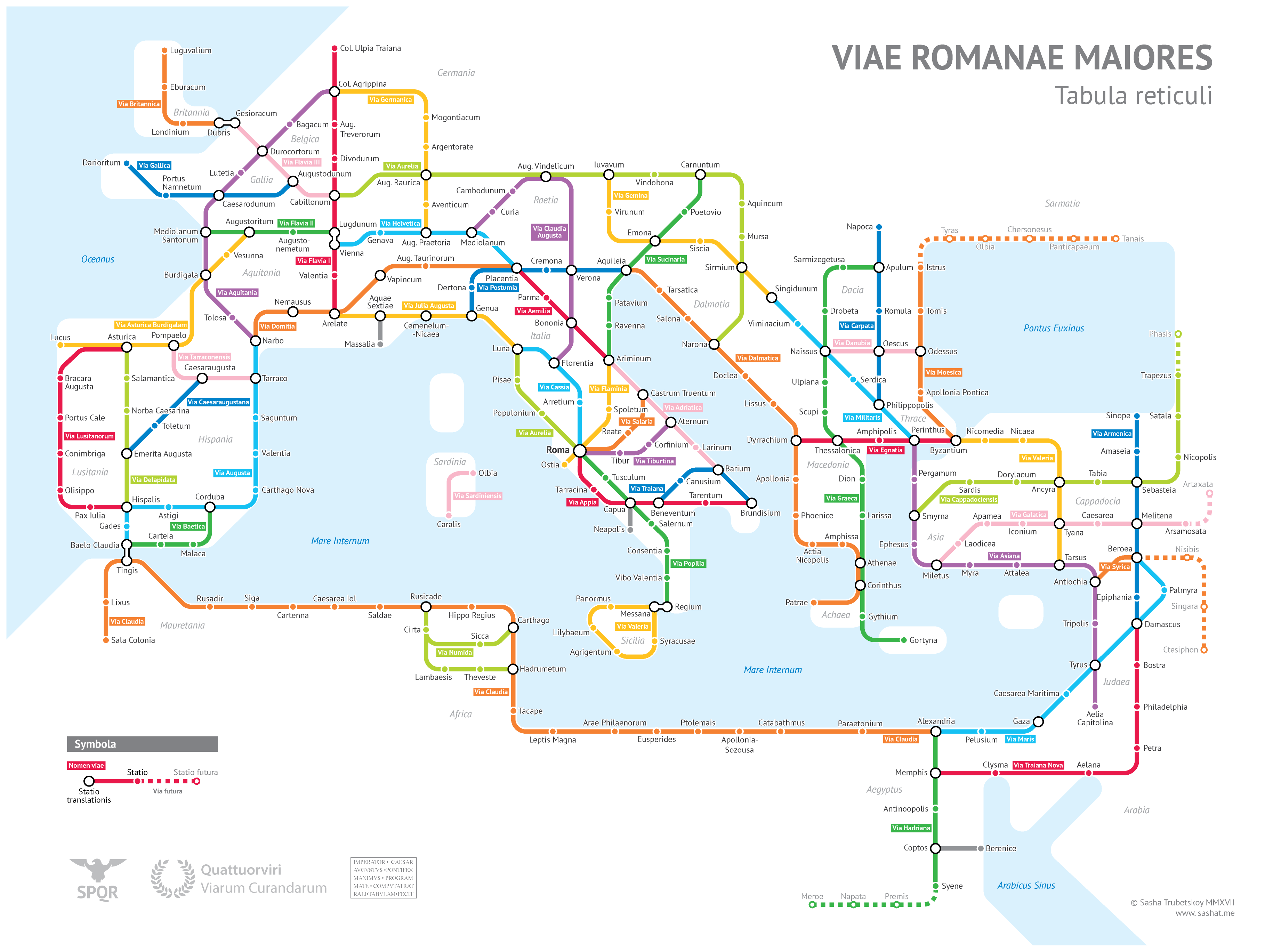
Sasha Trubetskoy, formerly an undergrad at U. Chicago, has created a “subway-style diagram of the major Roman roads, based on the Empire of ca. 125 AD.” Drawing on Stanford’s ORBIS model, The Pelagios Project, and the Antonine Itinerary, Trubetskoy’s map combines well-known historic roads, like the Via Appia, with lesser-known ones (in somes cases given imagined names). If you want to get a sense of scale, it would take, Trubetskoy tells us, “two months to walk on foot from Rome to Byzantium. If you had a horse, it would only take you a month.”
You can view the map in a larger format here. And if you follow this link and send Trubetskoy a few bucks, he can email you a crisp PDF for printing.